Saturday, September 21, 2013

Day 39-43: It's like the freakin' Mojave Desert out here!

Wait a minute! It is the freakin' Mojave Desert. Seems like I've been in it for days. I guess I have.


I spent a couple days kind of in Las Vegas. Let's put it this way. I drove around the edge of Vegas on Boulder Hwy and camped a couple nights in Henderson. This was one of those trips that I didn't really pay any attention to Vegas. I've been there so many times that I didn't go into a casino except to eat. I didn't go downtown. I didn't go to the strip. I spent time working on getting the last corrections to Mark's book made and off to the printer again and getting Jason's book finished, corrected, and sent to the printer. And I did some writing and prepping files for my new serial. Mostly, I tried to stay cool as Las Vegas hovered around 100 degrees.

On Thursday I drove on down to Blythe, CA and there was nothing between the two but desert. Even when I entered the Colorado River valley, it was desert on my right and green on my left. Like the road was a dividing line. I stopped in Needles at the BLM office (Bureau of Land Management) and was told that there were still some crews out, but the road repairs were finished. What repairs? From the floods last week. I could see signs of the damage as I drove south and passed a crew still scraping the sides of the road to remove sand from the highway and shape the waterways alongside.

My GPS started acting squirrely. First, it tried to send me West at a junction when the route was clearly south. Apparently it had out of date information about road conditions and was sending me on a detour that it invented. But then as I approached Blythe (about four miles out) I passed a sign that said Hidden Beaches RV Park was to the left. I thought it must be one of those things where there were multiple ways to get to the park. No. The GPS sent me 4 miles south to I-10. Then two miles west to the main drag through town. Then 4 miles north to a county road. Then 4 miles east, crossing the intersection where I'd originally seen the sign. I haven't figured out the purpose for that little bollux.

But, I ended up camped for two nights beside the Colorado River. That means that I've camped beside the Columbia, the Salmon, the Snake, and the Colorado so far. This water runs fast past Blythe, but it just doesn't look like a river that would carve the Grand Canyon a few miles northeast. And I guess that if you study it, you find out the river didn't actually carve the canyon. It was more of the glacial, volcanic, and water run-off action that cut the canyon and let the river find its course through it.


I was joined in my appreciation of the river by this beauty.


Saturday, I moved on the 110 miles to Palm Desert, CA where I am now ensconced in a small but comfortable condo with a pool and hot tub about a hundred feet from my door that are just calling for me tonight. The folks here at the Marriott Shadow Ridge are incredibly nice. I stayed here once a few years ago and am glad to be back. They gave me a bottle of wine because I'm here for my birthday. They had a place for me to park the trailer that's secure. They called in advance to find out what part of the resort I'd like a room in (third floor by the quiet pool). They found a room that was ready when I got here early. My parking spot is shaded most of the day. I have discount coupons for a couple dozen restaurants and I was able to grill a nice hanger steak for dinner.

That's a little of the downside. The kitchen consists of a toaster, microwave, coffeepot, and fridge. The trailer actually has a much better kitchen. So I guess I'm grilling of microwaving all meals this week. To celebrate that fact, I came up with a new recipe this evening and it was fantastic. I split a zucchini lengthwise and scooped out the core. I salted, pepperd, and herbed it, then filled the scoop with Gorgonzola cheese. Then I grilled it. Oh. My. Goodness! Combined with some of Uncle Ben's microwave rice pilaf, my first meal here was spectacular.

This week is focused on getting my serial finished and taxes. It's end of month and I haven't entered anything in the accounting software yet. I'll be correcting that between rounds of soaking in the hot tub. Speaking of which . . .

Tuesday, September 17, 2013

Days 34-38: Getting into Hot Water

Let me start by saying that the folks at Hi Desert RV Resort in Winnemucca were great and David knew as much about my trailer as I do. I discovered several things I was doing wrong and several more that I could improve. I had a great meal on Wednesday 9/11 at the Martin Hotel. It was Basque family style and I was seated with four ladies from Salem, Oregon who were on a road trip. They were all about the same age as me. One was a mother, grandmother, and great-grandmother. Two were school teachers. The fourth said she'd had a lot of careers, but everyone agreed she was in real estate. We laughed and told stories all evening and then headed out to play a while in the casino. I lost my twenty dollar limit and went back to my trailer and instantly asleep, rocked by the winds.

I worked most of the morning and early afternoon on "Bread for the Pharaoh" and we got "The Shiva Paradox" off to print for a proof. great accomplishments, so I decided to spend the afternoon doing some maintenance on the trailer. I had a broken light lens on the trailer, so I started by replacing it. I got a better connection for my sewer hose and got that connected along with some bio-digestive stuff to put in the black water tank. I got a couple of tape strips to help determine how much LP gas is in the tank. Then I decided to tackle the problem of the leaky joint on the hot water heater. I got some plumbing joint tape, but I decided to start off by just seeing if I could tighten the joint a little. I don't have many tools, so I just reached in with my fingers to see if it was loose.

It broke off in my fingers and water started spraying everywhere. I got all the water turned off, drained the tank, and then spent a good bit of the rest of the day sopping up the water off the floor. I also got the little piece off the pipe, but couldn't get the rest out of the joint in the water heater. Turns out it's some kind of plastic valve that prevents the water from running backward into the tank. And I was out of luck. I couldn't turn the water back on because without that valve, there was nothing to stop the water from flowing out that part of the tank.

I did some online research and discovered a Lance dealer in Reno--Sprad RV. I sent them an email and then followed up with a call indicating that I'd be in Reno by 1:00 on Friday and I needed an emergency repair. I took off early (8:00) Friday morning and during one of the rare times when I had cell service, the dealer called and said they were booked out a week for service. I said I was sure it would only take ten minutes to fix and I had no water in my trailer until I could get it fixed. (And no other Lance dealers between here and Palm Springs.) They told me to come on in.

Well, it took a little more than ten minutes, but I got a new valve and several little extras from their store. I grabbed a spot at Riverside RV Park in Reno and slept for a while. Then I decided to make a night of it. I went to The Nugget in Sparks and won enough playing blackjack to pay for a nice meal. With drinks and a show, of course, I way overspent what I'd won. Oh well. I crashed for the night and on Saturday moved out to Fernley, the beginning of what AAA calls "The loneliest highway in America," U.S. Hwy 50. To me, it was an opportunity to get my filthy truck and trailer washed!


These guys bring full 18-wheel rigs into their carwash and six of them attack the job. There were so many bugs and so much crap on the trailer that it was in bad need of a wash. As a bonus, the bike got clean, too.

I stayed at Desert Rose RV Park on Hwy 50, pointed toward Fallon, but on Sunday I decided to do some exploring and loop back to pick up the part of 95 that I missed by going straight into Reno. They might say that 50 is the loneliest highway, but that stretch of 95, and in fact the rest of it all the way to Las Vegas, is pretty barren.


I kept thinking that Judeo-Christian myths say God created the heavens and the earth in six days and on the seventh day, this is where he sat down.

In this bleak desert, though there was also water. I was surprised to come around a curve and see water as far as I could see, but still no greenery around it. This is "Twenty-mile beach" at Lake Walker. And yes, it's really water, not a mirage.


I'd decided to drive about 200 miles on Monday to Tonopah and get there early enough so I could claim one of the first-come first-served RV spots at the Model-T Casino. I pulled in and looked at the available spaces and decided to drive another 100 miles to Beatty. I'd been told there was a much nicer park there. I called ahead and was told sure they had room for me.


Believe it or not, the second picture is vastly superior to the first. And another trailer did pull in before full dark. The restrooms/showers were very nice and I had a little shade in the morning.

I was headed for Las Vegas on Tuesday, but while I was looking in the office and the maps, I discovered that I was just a few miles from Death Valley National Park. I always thought of that as all in California, but it turns out that a) part of it is in Nevada and b) I was only fifteen miles from California. So I got up early and was on the road by 7:00 to go to Death Valley. Wow! It's gorgeous. The climb up to Daylight Pass wasn't bad, but going down to Hell's Gate was hard on the poor truck. Some of the grades are so steep that (like Hells Canyon) I was in second gear so I wouldn't burn out the brakes. At least this road was paved. I only went about half-way down to the desert floor, but the temperature went up close to twenty degrees in the hour it took me to get there. At 8:00 it was near 90.


I got into Vegas about 1:00 in the afternoon and am camped here for a couple nights while I try to finish BFTP. Then I'll be headed into California for real. It has been hot everyplace and the headwind so strong coming down from Tonopah (6,000 feet) to Vegas (2,000 feet) that the truck has traveled in 4th or 5th gear (instead of 6th at 60 mph) most of the way. North of Vegas, the wind was so strong that I actually felt the trailer pulling at me and trying to swerve on the road. It's been really stable in all kinds of wind prior to this one. Haven't been able to use the awning at night for several days. I don't want to become a kite!

Thursday, September 12, 2013

Days 30-33: Leaving Idaho

I journeyed south from White Bird on Sunday morning after breakfast at Hoot's truckstop. Wasn't my first trip here, but the biscuits and gravy were the best of the lot. Then I was on the road, traveling through the Salmon River Canyon.


The Salmon River Canyon is almost as deep in places as Hells Canyon. I traveled along it for quite a while, crossing it and the Little Salmon thirteen times before I left Payette National Forest. Occasionally I just had to step out of the truck and walk along the river for a while.


Once out of the river valley at New Meadows, I was also officially out of the Pacific Time Zone and into Mountain Time. That meant I was truly in Southern Idaho. For about fifty miles, the right side of the road had been on Mountain Time and the left side on Pacific Time. I ended up at a beautiful campsite due west of Boise near Homedale, ID. This was gorgeous! Every site is grass and lush. Lots of trees. The Snake River was flowing right in front of the site. I spent three nights here so I could work with Mark on his new book, The Shiva Paradox. We sent it to the printer on Tuesday afternoon.


There were two downsides to this spectacular location. First, was the smell. Even the water attached to the trailer smelled like sewer gas and made a terrible cup of coffee. I was quickly into town the next morning to get bottled water.

And bug killer. That was the second problem. As soon as dark fell, thousands of little gnat-like bugs flew right through my screens and occupied every source of light in the trailer--including my computer screen. At 8:30 I had to give up, shut down every lightsource in the trailer that I could, and huddle under my blankets until morning. They don't have a long lifespan, so in the morning there were a lot of dead bugs. As soon as I sprayed the trailer, there were a lot more. I also sprayed all my screens so the little suckers couldn't get in again. Then I had to sweep up thousands of little creepy-crawlies. YUCK!


I left Homedale on Wednesday morning and after climbing to the pass ten miles south, I entered the flatlands. It was amazing. This is the Southern Idaho I remembered. I was going to stitch together a panorama, but it all looked exactly like this. The rest of Idaho and most of Oregon was like this, in fact.


A few miles before the summit of Blue Mountain Pass, I crossed back into the Pacific Time Zone. I'll be on Pacific time now until I get to Arizona, then it will depend on whether there is Daylight Saving Time still in effect or if the rest of the world is on Standard Time. I haven't sorted out which side the state goes to when it doesn't go on Daylight Saving Time. I'll find out when I get there.

At 5,200+ feet, Blue Mountain Summit was the highest pass I've come over so far. But the climb was only about 900 feet since I hadn't been below 4,300 for about fifty miles. Hardly even noticed I was going uphill. Of course, going down was the same. No curves. Just a long straight downward journey into Nevada.


Nevada has ridges of mountains surrounding the flat desert. The road gently curves to go around them, not over. What was impressive was that the speed limit changed from 55 in Oregon to 70 in Nevada with no difference in the two-lane road. Fortunately, there were enough long straight stretches of highway that semis who wanted to go 70 could go around my 55 pretty easily. I never changed the setting on my cruise control.


So that got me to Winnemucca, NV where I'm staying at the Hi-Desert RV park for two nights while I work on Bread for the Pharaoh and do a little sightseeing. Tomorrow, I'm heading somewhere in the general direction of Reno, though I don't know how close. See you then.

Sunday, September 8, 2013

Day 29: Hells Canyon

This marked the first day of my fifth week on the road and I celebrated by going to Hell. After I had breakfast.


I love cooking outside under the awning, mostly because the bacon grease doesn't splatter the inside of the trailer. Also, sitting outside in this weather with my morning coffee just seems right. So after lazing around for a couple of hours sorting papers and trying to get my life organized, I stopped for a cup of coffee at Nicole's Canyon House in White Bird and headed across the mountains into Hells Canyon.

The first thing to understand is that it's not possessive. It's not a canyon belonging to hell, but a canyon of many hells. Not the least of which is getting into it. Deer Creek Road travels up fourteen miles from White Bird gaining 1500 feet in elevation. It's narrow and twisty and took me easily twice as long to reach the top of the pass. I'm thankful the pass is only about 3100 feet as the surrounding mountains are over 7,000 feet. I won't overwhelm you with a hundred pictures (I didn't take that many) but some of the views on the way up to the pass were so stunning and moving that I wiped occasional tears from my eyes. The eastern side of the pass is simply beyond words.


Then after the pass there is the descent of 2000 feet in three miles. My poor truck was kept in first gear most of the time as we crept down the road. The mountains on the Oregon side of the canyon are over 8000 feet, making the 1100 foot elevation of the river the deepest gorge in the country. On this side, however, the best view is from the top.


It was a steep, but faster trip out of the gorge than into it. This time when I started down the "gentler" slope on the eastern side of the pass, I was paced by a doe and two fawns for nearly half a mile before they finally stopped and froze so I could take their picture. I think she just wanted a place where she could show off unobstructed.


There's an odd thing about the time zones here. White Bird, where I'm staying is still in the Pacific Time Zone. But Hells Canyon for some reason unknown to me is in the Mountain Time Zone, even though it is west of White Bird. South of me, I'll switch to Mountain Time for the rest of Idaho. The thing is that the cell tower that my phone gets its time from is on the east side of U.S. 95, so my 6:30 alarm rings at 5:30 a.m. in White Bird.

I rose before the alarm this morning (5:00 a.m.) at nature's call and discovered a leak in my hot water system. Water on the floor of the trailer. I've got it drained now and will get it fixed in Boise later. This is just before I begin my longest jaunt of desert and little if any services. Have to find a shop. I'll be moving to The Snake River Resort in Homedale, ID today, due west of Boise on U.S. Hwy 95.

Friday, September 6, 2013

Days 26-28: Finding the Nez Perce

It was fun getting out of Walla Walla. When I woke up (at Walmart) I discovered several others had joined me for an overnight in the parking lot. There was a bicyclist in the corner with a small tent and a wagon he pulled behind his bike. He took off early so I didn't get a chance to find out where he was from or headed. A few feet away from me was a Lance in-box camper. The couple were from Olympia and had decided to take a week and see southwestern Washington. They were very enthused about exploring the same kinds of things that I do. Another guy was camped out until his unemployment check arrived. He'd been working construction and was between jobs. From Medford, OR. He plays on the Professional Frisbee Golf Tour as well and figured that he'd be heading for Ventura soon. It was weird that we all stood in the parking lot with our cups of coffee and found out that all three of had the first or second name of Wayne.


P called just as I was leaving the parking lot and directed me to a filling station and then we found a place to park downtown so we could walk to Olive's for coffee and coffee cake. I think we sat there and talked for an hour before I said I really needed to get going so I could meet Q for lunch in Pullman. But I'd mentioned that I wasn't sure my hitch was set correctly and P said that he knew the guy at Melody Muffler and he was really good with hitches. So we drove over there and I met Mike Hammond. To protect the identity of the people I talk about, I usually just refer to them by first initial. But Mike deserves the publicity. He's my kind of guy. Check out his website at http://mikehammond.com/. He's not only a muffler man, he makes muffler art. And he sings and plays in a band ripping out some of the best electric blues I've heard. We traded. He gave me a CD and I gave him a book. I listened to the CD all the way to Pullman and was really rocking. Oh. There was nothing wrong with my hitch, but it took me 45 minutes to get out of Melody Muffler.

I picked up Q at her friend's house in Pullman about 1:30 and we headed out to eat at the New Garden Chinese Restaurant. The food was good and we had a chance to catch up and talk one last time before the darling daughter flies down to meet me for Thanksgiving at my sister's house in Texas. It was kinda sad to let go of her and head out to U.S. Hwy 95 to resume my southward journey through Idaho.


I quickly discovered that I was headed into Nez Perce land, including the Nez Perce National Historical Park. Just a few miles southeast of Lewiston, I came to the Museum and Park information station. It was fascinating. One of the best Park museums I've ever seen. It isn't huge, but if you get a chance, stop there. The ranger on duty was very helpful. In addition to the museum, you can watch a 20 minute video on the Nez Perce. There are children's activities. And I found out about the 38 historical sites in the park, many of which I was near. I think I stopped at every historical marker along the way and had a great time.


The one picture I wanted to put in here was too fuzzed to use. I must have been shaking or something. I stopped at a historical marker for an archaeological dig and it also had the story of Coyote and Black Bear. Coyote, the all-powerful animal spirit was having a good time fishing in the Clearwater River until Black Bear, the busybody, began to tease him. Finally losing his temper, Coyote tossed his huge fishnet onto the hills across the river . To teach Black Bear a lesson, Coyote threw him to the top of the hill on this side of the river and turned him to stone.

I could make out what I believed to be the pattern of the fishnet across the river. It's not much different than looking at the stars and seeing constellations. But then I turned around to look at the mountain and there was Black Bear. He was clear and locked in stone against the edge of the hill. Don't miss that historical marker if you go that way.

I made it to Grangeville at about 5:30 p.m. and pulled into the Sundown RV Park where I'd called ahead for a reservation. I didn't need much of a reservation for this place as less than half the spots were taken. It was a gravel bed and the wind whipped around so much that I couldn't leave the awning out. I was okay with that since the rain hit hard again that night.

The first person I met that evening was a stranded traveler with his family. He'd burned his truck out pulling his trailer across the pass and had been towed into the park. He was waiting for repair and checking on insurance. He did say that there was a much nicer park a mile away. I decided to check it out and immediately booked the next night at Bear Den RV Park. I figured I'd explore a little from Grangeville for a couple of days. These are the two sites. Bear Den was lightyears ahead of Sundown and only $2.00 different in price.


I planned to make the trip from Grangeville to Elk City, about an hour and a half away on a small two-lane road twisting through the mountains to the Salmon River. Unfortunately, I got only a small break in the rain to move my trailer and it stayed stormy until after 2:00 in the afternoon. I didn't want to try the trip in the rain and unpredictable conditions so I spent the afternoon writing and editing. I set up the grill and had one of R&A Paradise Ranch's incredible Hanger Tenderloins. A told me this was a perfect steak for me and she was absolutely right. They are long thin steaks, often called a butcher's steak because usually the butcher keeps it. They weigh between 5 and 8 ounces, a perfect size, and are so tender it's unbelievable. I'm glad I've got four more of them in my freezer!

The facilities at Bear Den RV Park are the best I've encountered anywhere. The shower facilities and restrooms are spotless. It has a large rec room with TV and games. I took advantage of the laundry facilities to do two loads and it was a bargain to pay only $6 total for wash and dry. The last Laundromat I was in cost that much just to get things washed. I used the showers on both Thursday and Friday. Nice!

After breakfast and doing a lot of trailer maintenance,  I headed up and across White Bird Summit (the hill that killed my neighbor's truck). I understood why. On the Grangeville side, it's a long slow climb, but not a problem to get to the 4,245 foot summit. The view was fantastic, but there was a sign that pointed further up a side road that said there was a summit lodge. I didn't trust taking the truck and trailer up there, not knowing if it would just deadend. So I walked. A mile and a half and another 700 feet in elevation. But it was worth it.


Frank and Terri Schmitz own and run the Whitebird Summit Lodge, a year-round bed and breakfast lodge on what I discovered was "Old Route 95." Terri was very kind and gave me a glass of water as I looked over the lodge. She and her assistant Leia were preparing large amounts of very good-smelling food for a group coming in this evening to take all seven rooms. Take a look at these great folks at http://www.whitebirdsummitlodge.com/. And if you are so inclined, "like" them on Facebook at https://www.facebook.com/whitebirdlodge. I did.


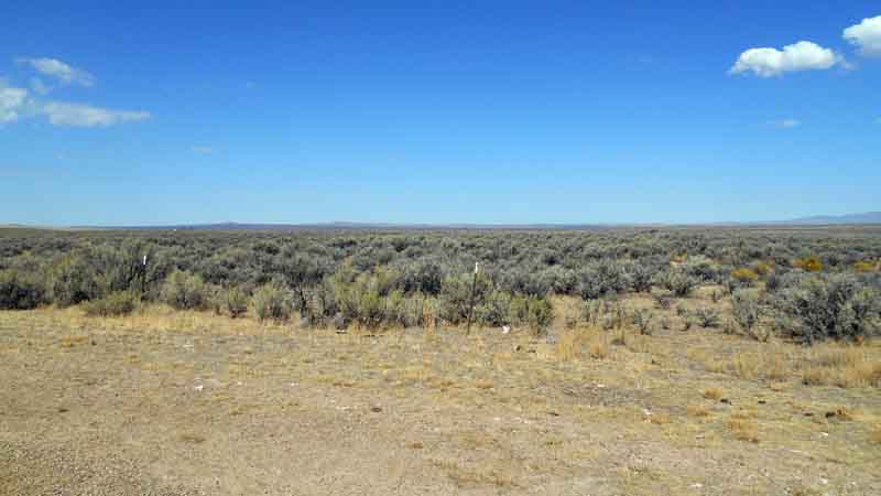
Just below the summit is another historical overlook site for the Nez Perce National Historical Park. I'm not going to go into a huge amount of detail about how the Nez Perce were (like most native American tribes) given land until it was deemed valuable. Then a new treaty (the Stealing Treaty) was put in place so whites could go after the gold discovered there. This picture shows the White Bird Battlefield where the first shots of the Nez Perce War were fired in 1877.


There is a walking tour of the Battlefield, and after I parked the trailer in the town of White Bird at Angel's Nook RV Park, I went for a hike. It was about 3:30 in the afternoon when I started the historical trail up to the peak above the cliffs in this picture (left center).


The view that the soldiers and volunteers would have had should have given them pause if it weren't for the fact that the natives were ready for them. The Nez Perce lost three men, the U.S. Cavalry 38, many as they retreated in disorder. The Indians immediately packed up their tents and village and moved to join other member tribes against what would be another enforcement of U.S. landgrabbing from the Native Americans.


I bring this up because when I got to the top of the cliff--a mile and a half walk along the white line below--I decided to take a second trail marked just below the summit (gain of 450 feet) that would loop around to the West of the next rise and back to the trailhead. It was supposed to be about the same length, making a 3 mile loop. Unfortunately, the trail was either poorly marked or just petered out, because it was close to three miles along the red line below until I finally made my way out of the park three-quarters of a mile below where I'd left my truck. Instead of a nice hour-long walk to the cliff and back, I was out about two hours and covered about five miles with a lot of up and down.


My important discovery was that even though I was better prepared for this walk than the walk to the summit of White Bird, I am not prepared for wilderness hiking. I didn't even take my cell phone! Stupid! I was in a fairly confined area, so I got along without my compass (stupid!). I did have my walking stick, water, and gloves. But before I head into Hells Canyon tomorrow, I'm working on what I'm carrying!

Thursday, September 5, 2013

Days 22-25: Finding Paradise

I got some work done on Sunday morning before I had to pack up and vacate my space at Wild Horse RV Resort in Pendleton. What I had before me was the long haul up Deadman Pass into the Blue Mountains. Just before I reached the top of the pass there is a fantastic panoramic viewpoint. I've tried to not pass a viewpoint, so of course I pulled over. I decided to try another stitched-together panorama. Click on it to zoom in. I'm getting better at it.


Of course, the real reason I was headed this direction was to visit R&A Paradise Ranch near Baker City, OR. I think it's Jeff Foxworthy that has a bit of stick called "You might be a redneck if ..." One of the lines is "If directions to your house include the words, 'Turn off the paved road...' then you might be a redneck." Well, if redneck is synonymous with good living, hard working, country people, then I would say R & A qualify. It was two and a half miles down this gravel road with the truck tugging along in 4x4 drive.


They came out from the house to meet me, but I was quickly ushered inside where we talked and caught up on a couple years worth of happenings while I cut up baby cucumbers for bread and butter pickles. A made the brine and got started on the syrup for peaches. By the time  the pickles were all soaking, we started peeling and canning four cases of peaches. A par-boiled them for 60 seconds then dumped them in cold water where R quickly stripped the skins from them. I picked them up and quartered and pitted them then stuffed them into quart canning jars. A took the jars, poured syrup over them, put the lid on and put them in the canning tub to cook for 25 minutes. We worked on the production line until we ran out of quart cans and started on pints. I'm glad we put up a few dozen of those as I got to bring a couple with me in the trailer. It was about 8:00 p.m. by the time we finished canning and A whipped up chicken-fried steak for dinner.


While we talked and canned, we covered a lot of ground. The conversation was great. R is a hunter and guide in addition to being a fine rancher and trailhand. When I mentioned that I used to have a horse and ride, A jumped at the chance  to go for a ride on Monday. I was thinking an hour or two riding out and back from the house. But A & R are avid trail packers and A wanted to go where she'd have a chance to bag a bear. (I was a little confused when she said we were hunting bare, but got straightened out pretty quickly!) It was pretty obvious that I was going to get to know Rika (short for Paprika) pretty well by the end of the day.


R had to put a shoe on Rika and two on his pack mule, Axel. Then we loaded up three horses and a mule, oilcloth dusters, and chaps and headed for the Willowa-Whitman National Forest. It was a few miles off the paved road on a forest road to the trailhead and about 12:30 in the afternoon, we were mounted and riding up the mountain on a narrow, rocky trail with a steep drop-off to Catherine Creek a few hundred feet below. It was a little scary because Rika doesn't neck rein and I was constantly pulling the wrong way. I'd never ridden a horse that turned toward the reins before.

An hour or so into our trek, we came to a weathered sign announcing that we were crossing into the Eagle Cap Wilderness Area. Another hour and we got to "The Meadow" where we stopped to graze the stock and eat lunch. Yes, it included some of those great canned peaches. Unfortunately, we were joined by a bunch of hornets and yellow-jackets. The idyllic scene I shot below was actually R trying to get a hornet unstuck from A's eyelash before it stung her again. One-sided botox treatment.


We continued on up the trail another hour or more into area that few people see. The weather improved and we were able to shuck the dusters and ride in shirtsleeves or jackets. I was feeling pretty good with my horsemanship skills by this time and was sitting comfortably enough on Rika that I could actually pull the camera out and take an occasional photo.


We finally turned back to head down the trail. I got this quick photo of the edge of the trail and yes, those are the tops of very tall trees just past the edge where I took the photo. Rika did admirably, even though she's only begun to change from race horse to trailhorse. She compensated for most of my inadequacies.


R & A thought it was some kind of record that we reached the trailhead before full dark. Apparently they'd never managed that before. Sadly, A didn't get her bear, but there are still several weeks of the season open. We got back to the ranch around 8:00 p.m. and took care of the livestock, unsaddled, and put them to pasture. By the time I finished that with R, A had spaghetti ready for dinner. I pretty much collapsed in my bed, just vaguely aware of the thunder and lightning and rain that moved in during the night.

Here are a couple more pictures from A on the trailride. And a reminder from her that when I got up Tuesday morning, I jumped out of my seat as soon as I sat to have coffee. I actually got a blister on my butt! It was worth it though.


We all needed to hit the road in the morning. R & A had pigs that needed to be to market by 10:00 and the calf got loose during the storm in the night and took a while to track down. She made it back to the farm when she heard the milking machine kick in. I got to shop in the meat freezer and chose several steaks to fill the freezer in my trailer. R & A had to leave before I was hitched up and I no more than got started raising my stabilizers when the cloudburst hit again. By the time I had the fourth stabilizer up, I was soaked to the skin. Soaked didn't begin to cover it by the time I was fully hitched and ready to go. I jumped back in the trailer and changed clothes and dried off before I dashed back to the truck to pull out. That little dirt road was fun to navigate in the rain!

I continued to have rain off and on as far as LaGrande, OR, then headed back across the pass to Pendleton and up to Walla Walla to get with P & K. I got a few things caught up and apologized to people for not telling them in advance that I'd be beyond cell phone/Internet range for three days. P & K fixed an incredibly good king salmon, wild rice, salad, and veggies for dinner, then I hauled the trailer over to the local Walmart where I parked for the night. Several other cars and RVs pulled in over night and I slept peacefully.

Tuesday, September 3, 2013

Days 18-21: Bellevue to Pendleton.

Due to unforeseen circumstances (I was out of range of cell contact), this post is a little late getting up and another will follow almost instantly. Okay, I'll wait till tomorrow morning.

A week before I started my trek, D and T sent me an email saying they would be in Bellevue at Vasa Park on the 29th and 30th and hoped I'd be there. So I swung back to Bellevue on the 27th and booked in at Vasa Park.


It's a nice space and First Exit is happy there, even though I can't stay the 30th and have to park on the street at the homestead. I had a nice barbecue for folks on Thursday night, including K, Q, M, S, D, and T. We kind of ate in shifts at the little table because it was raining like crazy outside. That proved to be a continuing theme this week.


Isn't it amazing that I can serve seven at this table? I had to see the dentist again and take the truck in for service while I was back. I've since discovered all kinds of things I want to add to the truck, but they will go forward one at a time as I can afford it. I'd never have thought of the use for bumper guards!

Nonetheless, on Friday, D & T & I did some of the typical tourist things on the east side. First we headed for Snoqualmie Falls. The falls were kindly running--perhaps not as fast and furious as at times in the winter, but still putting on quite a show. We had a great meal in the Attic at Salish Lodge and then headed out for Mount Si to hike for an hour. Well, it was an hour up and forty minutes back.


Saturday morning we broke camp and began our caravan down to the Wild Horse Resort and RV Park near Pendleton, OR. We'd heard dire warnings about attempting Snoqualmie Pass until mid afternoon, so we elected to head south to U.S. Hwy 12 at Morton. A detour was marked on WA 7, but we found out it was lifted for the holiday weekend, so cruised down that way anyway. We were treated to some great sights.

For a while I thought this was the only view of Rainier that we'd have. It was far away.

 
When we headed east on Hwy 12, we were surprised by the several miles of traffic backup through Packwood, WA, a town that hadn't even shown up on my map. It's just a couple miles from the entrance to the national park and about ten miles from White Pass. Hundreds and hundreds of people were there for an enormous flea market that was at least a mile long. I was seriously thinking we had made a bad decision regarding our  route. That's when we got the first view of Mount Adams.


That was pretty cool. There's no big viewpoint marked. We saw it and pulled both trailers to the side of the road to go find the picture. Beautiful. As we approached White Pass, though, we were in for another surprise as we pulled into the Mount Rainier viewpoint. I'd never seen the southeast side of Mount Rainier. My gosh! It's incredible, rugged, and close!


We finally got to Wild Horse after discovering that it was still 200 miles away from White Pass. The total drive for the day was 368 miles and 11 hours. We were all pretty exhausted and barely got dinner before the buffet closed at 9:00. I did, however, play my ritual $3 on Keno and won $40! I said goodbye to D&T and we headed our separate ways. They'd be gone before I broke camp in the morning.